


20. Falachfaen History
A slate-quarry town clinging to the southern slopes of Rathmor. Surrounding hills now used as a Ministry of Defence training camp.
History
Towns
Falachfaen
Falachfaen Maps
Falachfaen
Falachfaen (FAH-lakh-vine) – From Welsh ffalach “hidden, concealed” and maen/faen “stone, rock.” Meaning “Hidden Stone” or “Concealed Rock.” A fitting name for a settlement built on quarried cliffsides where slate was wrestled from the mountain.
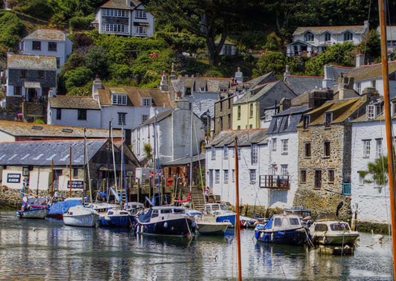
Falachfaen
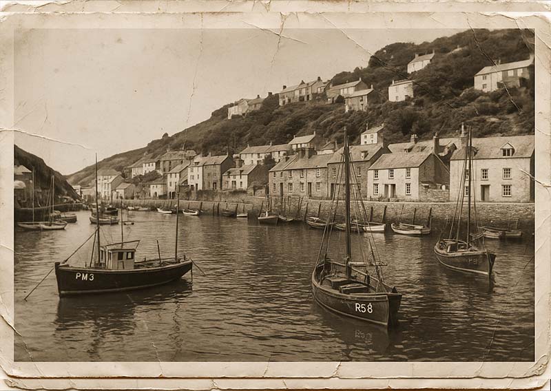
Falachfaen c1930
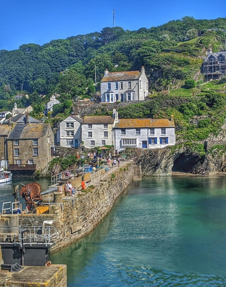
Falachfaen Harbour
The town of Falachfaen seems almost precariously balanced on the southern slopes of Rathmor, where terraces of cottages and winding lanes cling to the hillsides between gashes of old slate quarries. For centuries, this was a town defined by the ringing of hammers and the grinding of wagons as men cut slate from the mountainside and sent it down to the waiting boats on the coast.
The slate here was particularly prized for its dark blue-grey colour, strong yet workable, and it was exported widely across the islands. At its height in the 19th century, the Falachfaen quarries employed hundreds, the town swelling with chapels, taverns, and workers' terraces that stepped up the slopes like ledges cut into the rock.
But industry alone does not define Falachfaen. To the south-west is the Falachfaen Peninsula, now claimed by the Ministry of Defence, which since the 1930s has run a training camp and airfield across some 20,000 acres. The sound of gunfire and manoeuvres echoes where once quarrymen worked, a reminder that the land continues to serve purposes of power and endurance.
Though much reduced from its industrial peak, Falachfaen remains proud of its heritage. Visitors today find a community bound together by its history—its quarries, its narrow streets, and its resilience in the face of both man-made and natural upheaval.
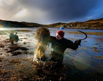
Kelp harvesting – Falachfaen
Seaweed Farming in Falachfaen
Tucked into the sheltered southern fjords of Rathmor, the community of Falachfaen has built its identity upon one of the islands’ oldest and most enduring coastal traditions: seaweed farming. The region’s cold, nutrient-rich waters support vast natural forests of kelp, and for generations local families have carefully cultivated and harvested these underwater fields. What began as a small-scale coastal practice has grown into a thriving cottage industry, its methods and secrets preserved and passed down through the years.
Kelp gathering in Falachfaen follows a time-honoured rhythm. Farmers harvest the long fronds at low tide, cutting them in a way that encourages rapid regrowth. The seaweed is then laid out on stone terraces and wooden racks to dry in the sun and salt air. Once thoroughly dried, the kelp is burned in pit kilns, producing a dense, glassy ash known as potash. This substance, rich in minerals, has long been valued across Rathmor for its versatility and chemical properties.
Historically, potash was prized as one of the island’s most reliable fertilisers, helping to enrich the thin soils of upland farms. But Falachfaen’s product soon found its way into more specialised industries. At Talporth, the centre of the islands’ glassmaking tradition, the potash serves as a vital flux, lowering the melting point of silica and making high-quality glass production possible in the island furnaces. This relationship between the kelp farmers of the fjords and the glassworkers of Talporth has endured for over a century, with each depending on the other’s craft to maintain their livelihoods.
In more recent years, the seaweed industry has found yet another outlet in the booming cement production of Porthelan. Here, potash derived from Falachfaen kelp is used as an important ingredient in the island’s distinctive cement blend, further highlighting the material’s industrial significance.
Despite increasing demand, the people of Falachfaen have remained committed to sustainable practices. Their careful stewardship ensures that the kelp forests remain healthy and abundant, allowing future generations to continue this ancient maritime craft. Today, seaweed farming remains both a cornerstone of local culture and a quietly powerful engine of Rathmor’s interconnected industries—proof that even the humblest natural resource can shape the fortunes of an entire region.
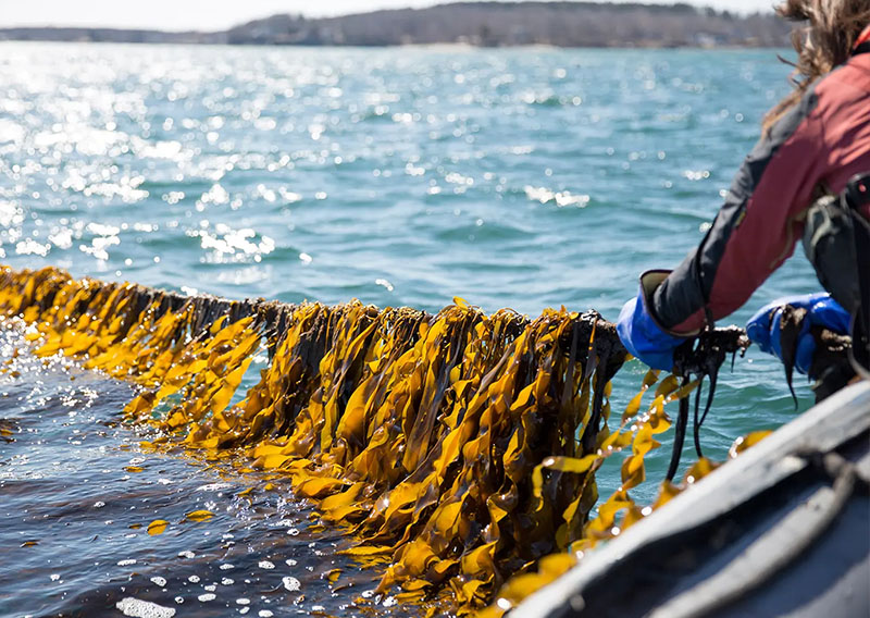
Falachfaen Seaweed Co
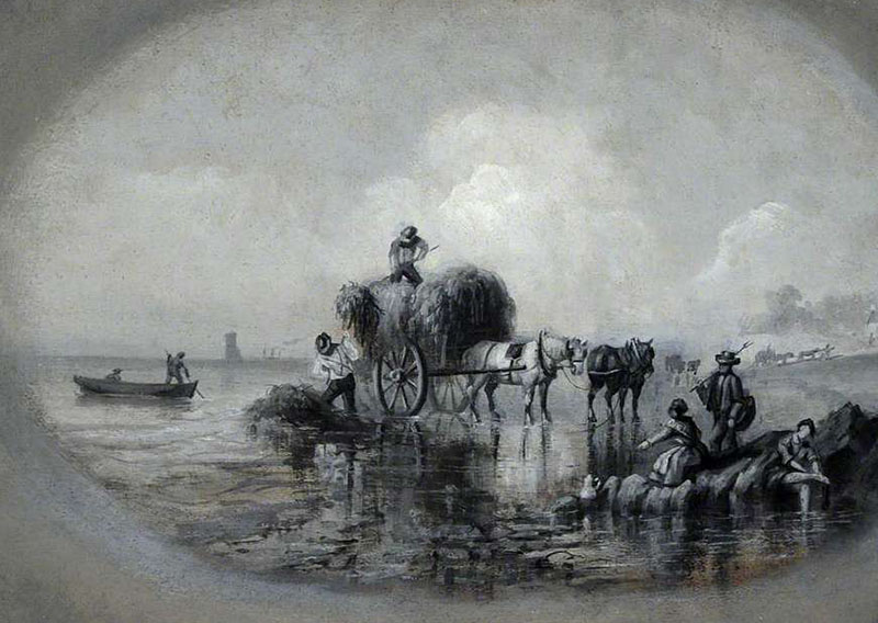
Early seaweed harvest, Falachfaen c1850

Falachfaen Rifle Range
The Defence Lands of South-West Rathmor
In the mid-1930s, with tensions rising across Europe, the Ministry of Defence turned its attention to the Islands. The south-western tip of Rathmor, with its secluded Falachfaen Peninsula and sparse population, was chosen as the site for a new training ground. Over 20,000 acres of land were requisitioned, encompassing farms, villages, and open heath. Families were relocated, and stone cottages abandoned, leaving behind ghostly traces of a rural life that once flourished there. To this day, ruined walls and roofless barns can still be found hidden among gorse and bracken, silent reminders of the sacrifice made in the name of national security.
At the heart of the complex lies a small airfield, built in 1937. Initially grass runways and a few hangars, it later expanded during the Second World War into a base for reconnaissance aircraft and training squadrons. Pilots practiced navigation over the wild Atlantic, while ground troops used the surrounding terrain for exercises in live fire, manoeuvres, and armoured warfare. The area’s isolation and rugged landscape made it an ideal proving ground.
Though the war ended long ago, the Defence Estate remains active. The airfield is now modest in scale but still in use, with training flights and joint exercises occasionally visible to curious onlookers along the coastal paths. Large swathes of moor are marked with warning signs and red flags, barring entry when training is underway. Yet at quieter times, the land is accessible to walkers, and nature has reclaimed much of it, turning firing ranges into wildflower meadows and reservoirs for wildlife.
Locals often speak with mixed feelings about the site: pride in its contribution to the islands’ defence, tempered by memories of lost homes and fields. The south-west of Rathmor thus holds a unique dual legacy—both as a symbol of sacrifice in times of conflict and as a landscape where military purpose and natural beauty now exist side by side.
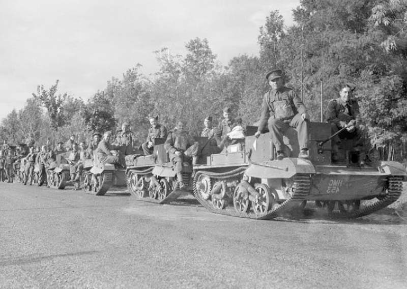
Army Training - Falachfaen Camp
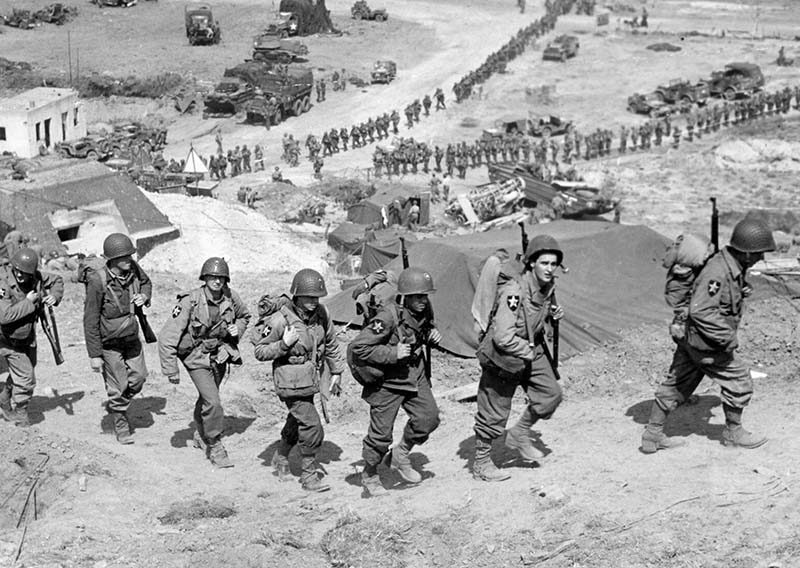
D-Day training - Falachfaen Camp 1944
The Railway to Falachfaen
Bringing the railway to Falachfaen was an epic struggle against the very land itself. The southern coast of Rathmor is hemmed in by the jagged ridges of the Trevelyan Heights, leaving engineers with little choice but to push the line along a perilous cliff-hugging route along the south coast. Work began in 1880 with great optimism, but the project was soon beset by delays and disasters.
Rockfalls buried sections of track, tunnels collapsed during excavation, and in 1885 a fierce autumn storm swept away nearly half a mile of newly laid railway, casting it into the sea below. So many setbacks plagued the construction that locals whispered the line was cursed, and petitions were even raised to abandon the venture altogether. But the promise of opening Falachfaen to the slate trade was too great to ignore.
After nearly a decade of hardship and cost overruns, the line was finally completed. On 27th September 1890, almost ten years to the day from its beginning, the first train steamed into Falachfaen station. The achievement was celebrated with brass bands and banners, though the weary engineers knew every arch and embankment had been won against the mountain’s resistance.
The line transformed Falachfaen. Slate wagons now rumbled out daily, and passenger trains brought both workers and visitors into the once-isolated town. Though it was born of difficulty, the railway became the lifeline of Falachfaen, binding it to the wider island and carrying its hidden stone far beyond the southern slopes.
With the need to supply the MOD base from the deep-water harbour at Llanchala the line has seen several upgrades over the years. Three bridges have been strengthened for the heavier loads and some of the sharper bends have been smoothed out somewhat. The seawall has been upgraded a number of times against the fierce Atlantic winter storms and the line was even redirected across the Bodmin Dam after it was constructed in 1935, reducing the journey by nearly two miles. Not only does this help the Ministry, but the town has a much faster and more reliable connection to the network. Long may that continue.
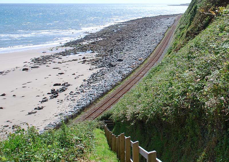
Route to Falachfaen
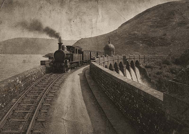
Crossing the Bodmin Dam c1940
History
Towns
Falachfaen
Falachfaen Maps
Falachfaen
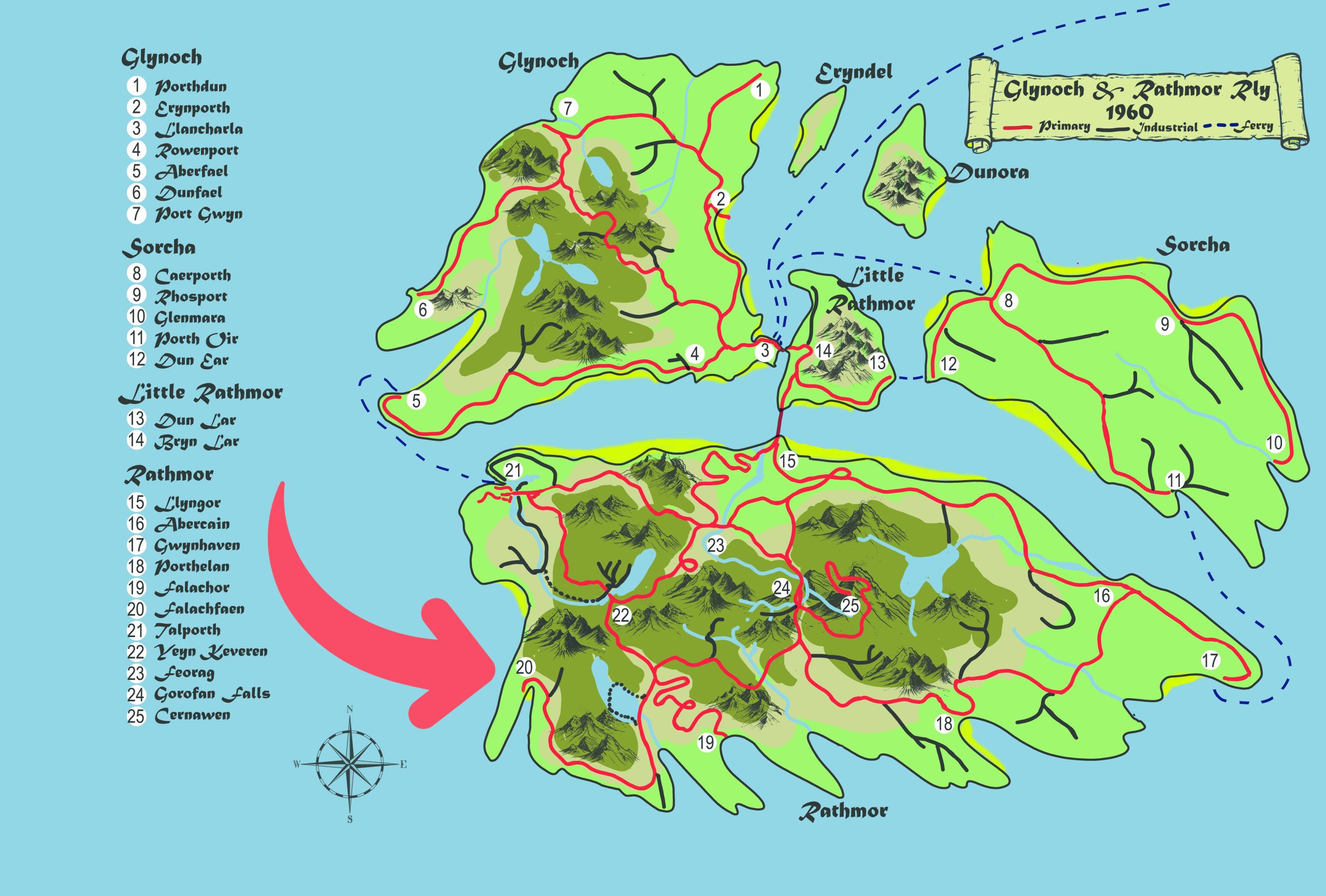
Located on the south-west coast of Rathmor
Explore More Towns...
...View All Towns