


22. Yeyn Keveren History
Long associated with mining and industry, the name also carries connotations of power and endurance in a harsh highland setting.
History
Towns
Yeyn Keveren
Yeyn Keveren Maps
Yeyn Keveren
Yeyn Keveren (YEIN KEV-er-en) – Likely from Cornish teyrn “lord, king” and personal name Keveren. Meaning “The stronghold of Lord Keveren.” Long associated with mining and industry, the name also carries connotations of power and endurance in a harsh highland setting.
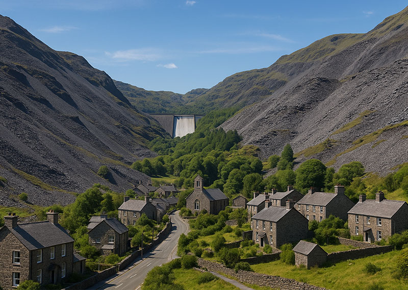
Yeyn Keveren village
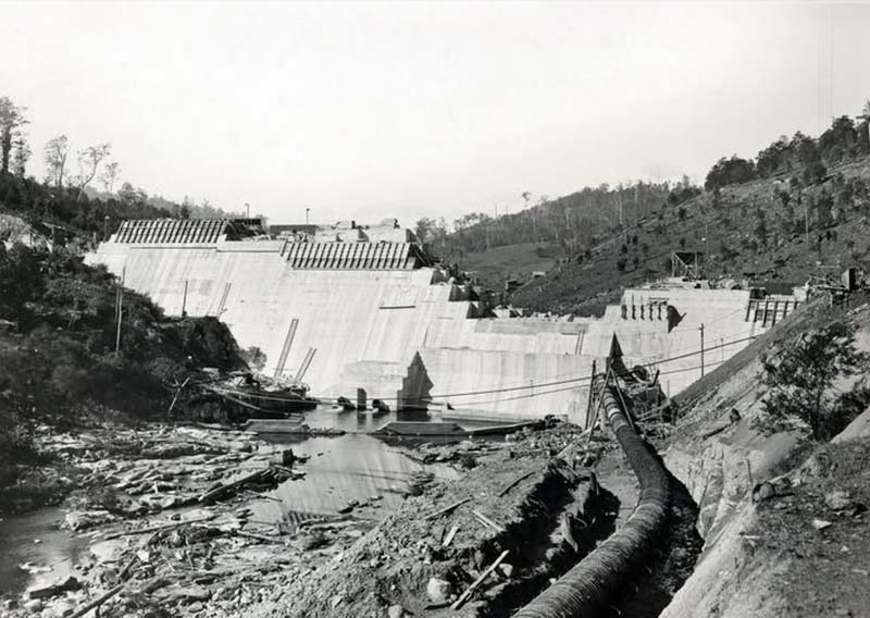
Torra Sine Dam Construction c1909
High in the rugged central highlands of Rathmor, perched among ridgelines where winter frost clings long into spring, lies the iron-willed town of Yeyn Keveren. It is a place shaped as much by its dramatic landscape as by the generations of people who have worked its quarries, mines, and workshops. Here, the wind whistles down steep valleys, carrying with it the clang of tools, the chatter of workers, and the distant rumble of freight wagons threading their way along the mountainside railway.
For centuries, Yeyn Keveren formed the industrial backbone of Rathmor, famed for its rich seams of tin, copper, and zinc, and the slate quarries that once roofed half the islands. The narrow streets still bear the marks of this heritage—the stone cottages, the old engine sheds, and the labyrinth of tramway cuttings that once hauled ore down to Talporth. Even today, the hillsides are marked with the angular outlines of spoil heaps and the proud silhouettes of mine chimneys, reminders of an era when the town’s fortunes rose and fell with the price of metal.
The 20th century brought a new chapter of ambition with the construction of the Torra Síne Dam, a monumental undertaking that reshaped the valley above the village. Its vast reservoir now serves as a crucial source of fresh water for much of Rathmor, while its turbines transformed the region into a hub of hydroelectric power. The low hum of the generators forms a modern counterpoint to the age-old echo of hammer on stone, symbolising the blending of innovation and tradition that defines the town.
Life in Yeyn Keveren has never been easy. Winters are harsh, the work demanding, and the isolation profound. Yet the people here take deep pride in their resilience and in the fierce sense of community that binds neighbours together. Visitors are welcomed with straightforward warmth—best experienced in one of the hillside inns, where stories flow as readily as the local ale and where every conversation carries the unmistakable character of a town forged by stone, water, and determination.
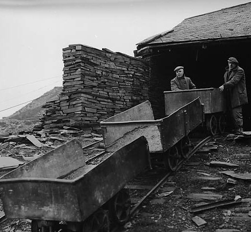
Slate Incline
The Slate Industry of Yeyn Keveren
The story of Yeyn Keveren is written in stone—specifically, in the glittering grey-blue veins of slate that run through its highland valleys. Slate was first discovered here in the early 18th century, when farmers noticed that the thin, splitting rock made excellent roofing for their cottages. By the late 1700s, small family quarries dotted the hillsides, supplying local demand.
It was the arrival of organised investment in the 19th century, however, that turned Yeyn Keveren into the slate capital of the islands.
As demand for roofing slate soared across Europe, vast quarries and underground mines were opened, their terraces stepping down the mountains like amphitheatres of industry. Yeyn Keveren’s slate was valued not only for its durability but also for its distinctive silver sheen, which caught the light even on grey days. At its height, thousands of men worked in the pits, wielding hammers and chisels, while wagons rattled down inclines to the railway sidings. Whole villages grew around the quarries, their chapels, schools, and taverns filled with the rhythm of slate life.
Yet the industry was not without hardship. Work was dangerous, with frequent rockfalls and lung disease from stone dust. Strikes and disputes over pay and conditions were common, reflecting the harsh realities of industrial life. By the mid-20th century, competition from cheaper roofing materials and the decline of heavy industry led to a sharp fall in demand. Many quarries closed, leaving behind scars in the landscape and memories of an age when Yeyn Keveren slate roofed half the islands.
Today, a few quarries remain in operation, supplying heritage markets and specialist projects. The rest have become part of the cultural heritage of Rathmor, their echoing galleries and towering spoil heaps reminders of the community once forged from stone.
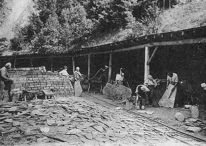
Yeyn Keveren slate working c1900

Slate Workers at Yeyn Keveren c1910
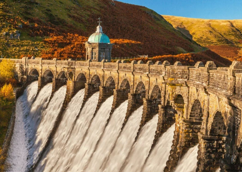
Fael Dam - Glynoch
The Rise of Hydropower and Reservoirs
As the 19th century gave way to the 20th, the Islands faced a modern challenge: how to supply their growing populations with both reliable electricity and secure sources of fresh water. Rathmor, with its expanding industries and towns, was the first to act. Its mountains and valleys provided natural sites for dams, and engineers seized the opportunity to harness falling water for power. Between 1910 and 1935, three great dams were constructed in the western and central highlands of Rathmor. Each created vast reservoirs, providing not only hydro-electric power but also clean drinking water for thousands of islanders.
The first, Torra Sine Dam, was built in a steep glen above Yeyn Keveren . It opened in 1910. Hydro turbines powered local industry and all the towns in the north of Rathmor.
The largest, The Great Cernawen Dam, rose in the heart of Rathmor’s forests in the foothills of the great Cernawen peak, its great wall of stone holding back a glittering lake. This reservoir was part funded by the farming industry on Sorcha, who were always looking for ways to guarantee supplies of freshwater. As part of the construction a gravity-fed water pipe was laid under The Straights and filled an underground reservoir in the middle of Sorcha, which in turn was used to irrigate farms all across the island.
Finally, in 1935 came The Bodmin Reservoir, (named in honour of the 12th century derelict monastery now under the reservoir), in the next valley across from Falachor, serving the south with irrigation and storage. This was later used as a pumped-storage facility for the nuclear plant further down the valley. The reservoir behind the dam actually cut off the railway to Falachfaen, but thanks to some clever design (and at the insistence of the Ministry of Defence base at Falachfaen) the railway was re-routed along the new dam wall, which actually cut the journey time to the outlying villages.
Folklore quickly attached itself to the new waters: people spoke of drowned villages beneath the depths and water spirits angered by the damming of rivers. Festivals marking the reservoirs’ completion blended awe at modern engineering with age-old respect for the forces of nature.
On the island of Glynoch, reclamation of the northern marshes had already shown how human ambition could reshape the landscape. By 1930 Glynoch followed Rathmor’s lead with the construction of the Port Gwyn Reservoir, fed by upland streams. It served a dual purpose: hydroelectric turbines powered local quarries and mills, while the reservoir secured fresh water for the growing towns of north Glynoch. Finally the grand Fael River (Wolf River) was tamed and the Fael Dam, inland from Dunfael, was completed in 1938.
Together, these dams symbolised the islands’ step into modernity. They turned rushing rivers into steady power, gave secure water to farms and homes, and showed that the Celtic Islanders could adapt ancient landscapes to the needs of a new century—without entirely losing the folklore and reverence for nature that had always defined them.
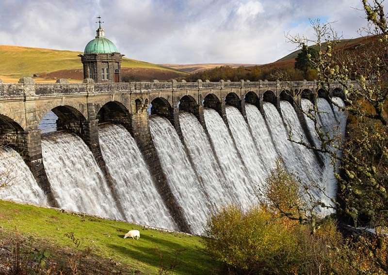
Bodmin Dam - Rathmor
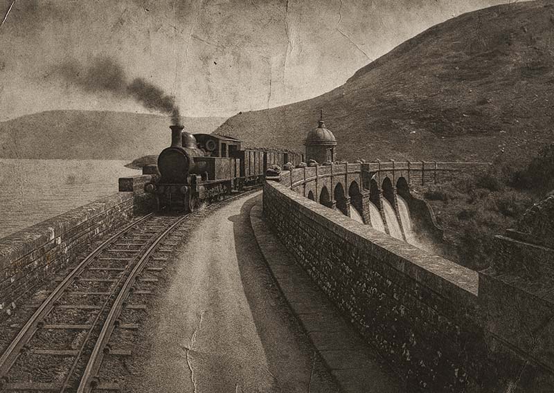
Crossing the Bodmin Dam c1940
The Railways to Yeyn Keveren
The story of Yeyn Keveren is inseparable from the railways that climbed the highlands to serve its industries. The first attempt came in 1845, with a horse-drawn plateway running up the valley from Talporth. Rope-worked inclines were used to haul slate down and supplies up, an arduous system that nonetheless tied the quarries to the outside world.

Slate Tramway c1850
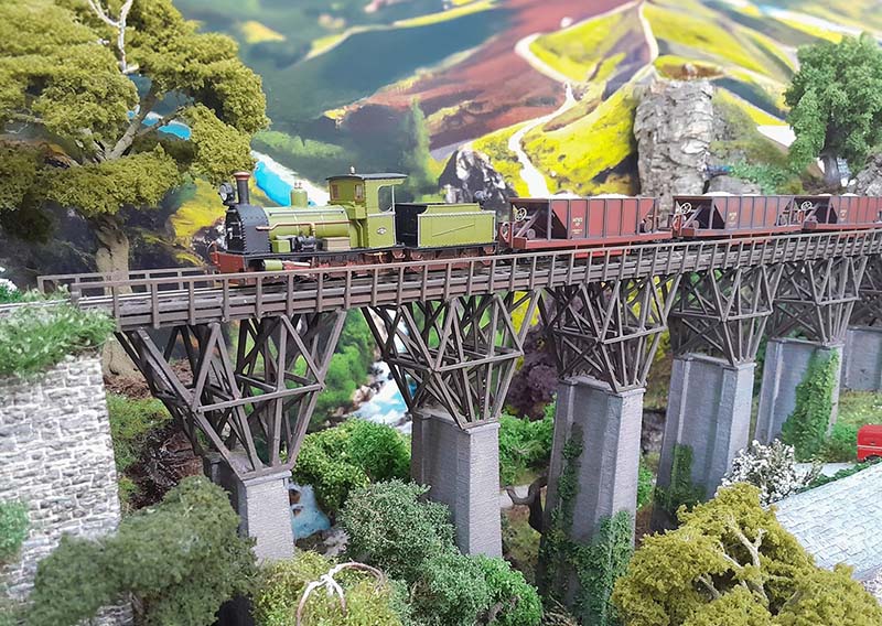
By 1862, progress brought locomotives. A steam-hauled line replaced the plateway, again from Talporth, with iron rails and heavier wagons to handle the ever-growing output of slate. In 1880, a key breakthrough came when a bridge was constructed over the river, allowing the line to extend southward into the southern mining districts and coastal communities, eventually reaching Falachor in 1882 and Falachfaen in 1890. This connection changed everything, turning isolated communities into thriving trade hubs.
The final railway to reach Yeyn Keveren was opened in 1909, climbing up from Feorag. This was no mere industrial line—it was essential to the construction of the Torra Síne Dam, carrying supplies, machinery, and workers into the high valleys. The line became an artery of progress, ensuring the dam’s completion and leaving behind a permanent rail link that strengthened Yeyn Keveren’s role in the islands’ economy.
Today, the railways remain both practical and symbolic. Rusting sidings and still-busy quarries alike remind visitors that without iron rails, slate wagons, and puffing engines, Yeyn Keveren would never have risen to prominence. The railway here is more than transport—it is the very foundation upon which this highland community was built.
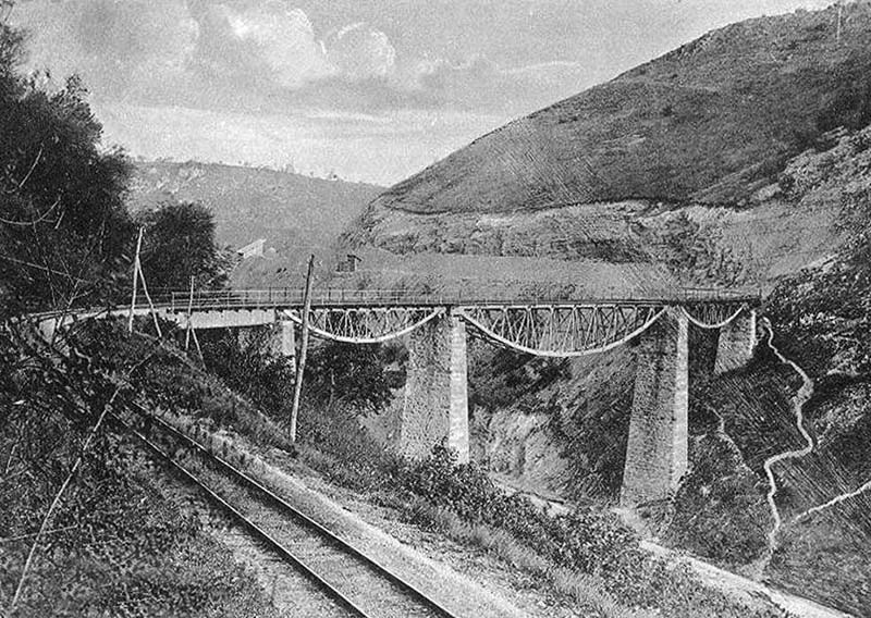
New Bridge c 1880
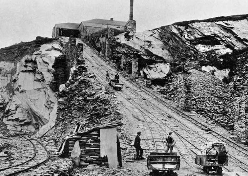
Yeyn Keveren incline no.3 c1885
About
Map
History
Towns
Yeyn Keveren
Yeyn Keveren Maps
Yeyn Keveren
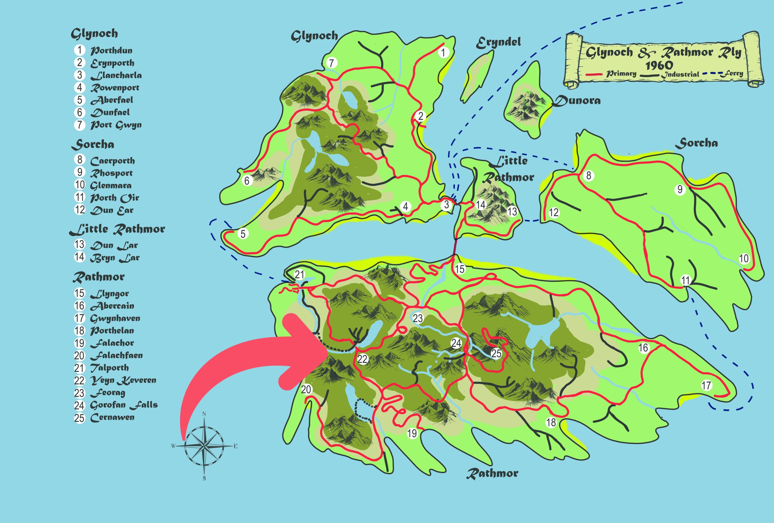
Located in the western highlands of Rathmor
Explore More Towns...
...View All Towns